Beautifully-preserved wrecks of the ships which held the mighty Ottoman Empire together have been discovered during a climate-survey of the Black Sea bed.
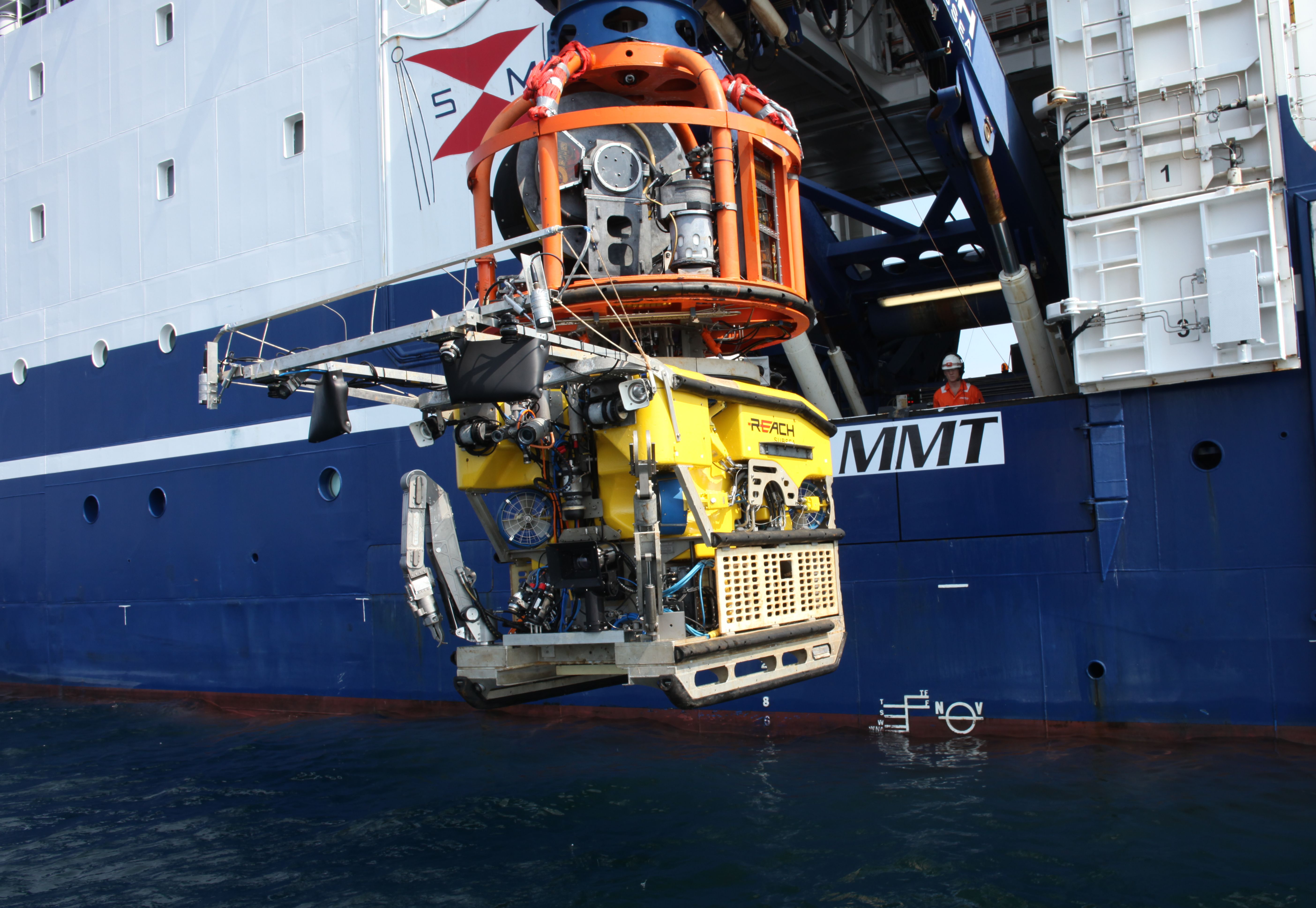
An international team led by Southampton University’s Professor Jon Adams has found over 40 wrecks from the Ottoman, Byzantine and Roman periods using state-of-the-art underwater ROVs (Remotely Operated Vehicles).
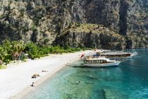
The stunning remains were filmed and mapped in 3D photogrammetry* as an incidental part of geophysical surveys to find out how rising water-levels affected human beings in the Bulgarian area of the Black Sea after the last Ice Age (around 9,700 BC.). During its long existence, from AD 1300-1923, the Ottoman Empire controlled much of the land surrounding the Black Sea.
Says Professor Jon Adams: “The wrecks are a complete bonus, but a fascinating discovery. They are astonishingly well- preserved due to the absence of oxygen in the Black Sea below 150 metres.”
“The primary focus of this study is to detect former land surfaces below the sea-bed, take core samples, and date them, so as to build up a palaeo-environmental study of Black Sea prehistory.”
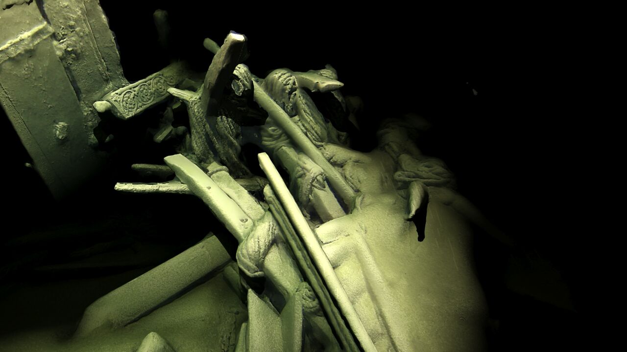
“Using the very latest recording techniques for underwater structures, we’ve been able to capture some astonishing images without disturbing the sea bed. We are now among the very best exponents of this methodology, and certainly no-one else has achieved models of this completeness on shipwrecks at these depths.”
“One of our ROVs set new records for depth – 1,800 metres – and sustained speed- 6+knots-covering a distance of 1,250 km during the survey.”
The Black Sea MAP (Marine Archaeology Project) was funded by the Expedition and Education Foundation (EEF). It confirms Southampton’s supremacy where marine archaeology is concerned, and brings it together with leading academics from Bulgaria, Sweden, America and Greece.
It will take years for so many wrecks to yield all their secrets, but already experts can tell the finds will take us well beyond our present – largely written – sources for this period.
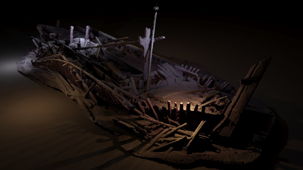
Main picture: a shipwreck from the Ottoman period discovered in 300m of water. Many of its timbers are carved. This image is a photogrammetric model created from photographs taken by cameras on the ROV, rendered with light sources (Credit: EEF, Black Sea MAP).
*Photogrammetry is a process which constructs a 3D model by computing the position of any feature which is visible in any two adjacent images. Software built the models by computing the position of millions of points in space, taking many days on six of the world’s fastest computers.